1. Physical and human geography
Khorat Geopark is situated in the middle to lower Lam Takhong Basin in Nakhon Ratchasima Province, Northeast Thailand. The geopark covers 5 out of 32 districts in the province, Sikhio, Sung Noen, Kham Thale So, Mueang Nakhon Ratchasima, and Chaloem Phra Kiat, extending from 14° 40' 31'' to 15° 08' 59'' N Latitude and 101° 23' 51'' to 102° 23' 49'' E Longitude. The total area is 3,167.38 sq.km. The geopark is 170 km northeast of the Thai capital Bangkok, and 170 km south of Khon Kaen, a major city in Northeast Thailand. The geopark can be divided into 3 topographical regions:
The highest and lowest points are 782 and 163 meters amsl, respectively. The major rivers flowing through the geopark are the Lam Takhong and Mun River. The climate is classified as Tropical Wet and Dry, with an average annual precipitation of 1,019.2 mm and average annual temperature of 27.4°C. The natural vegetation in the plains and low hills is mostly deciduous dipterocarp forest, and in mountainous areas mostly dry evergreen forest. The population size is 741,239 persons (2018), comprising mainly Thai Khorat, Thai Northeastern (Isan), and Thai Chinese groups, with minorities including Thai Muslim, Thai Yuan, and Thai Sikh groups. The major economic activity in the geopark area is agriculture, with cultivation of rice, cassava, and sugar cane and raising of cattle, pigs, and chickens. In Nakhon Ratchasima city and in district cities, the majority of the population is engaged in industry, commerce, and services, with Nakhon Ratchasima city a center of Northeast Thailand. Nakhon Ratchasima is a regional highway and railway transportation center.
2. Geological features and geology of international significance
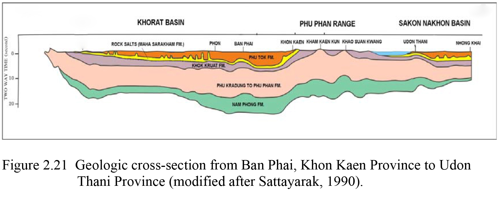
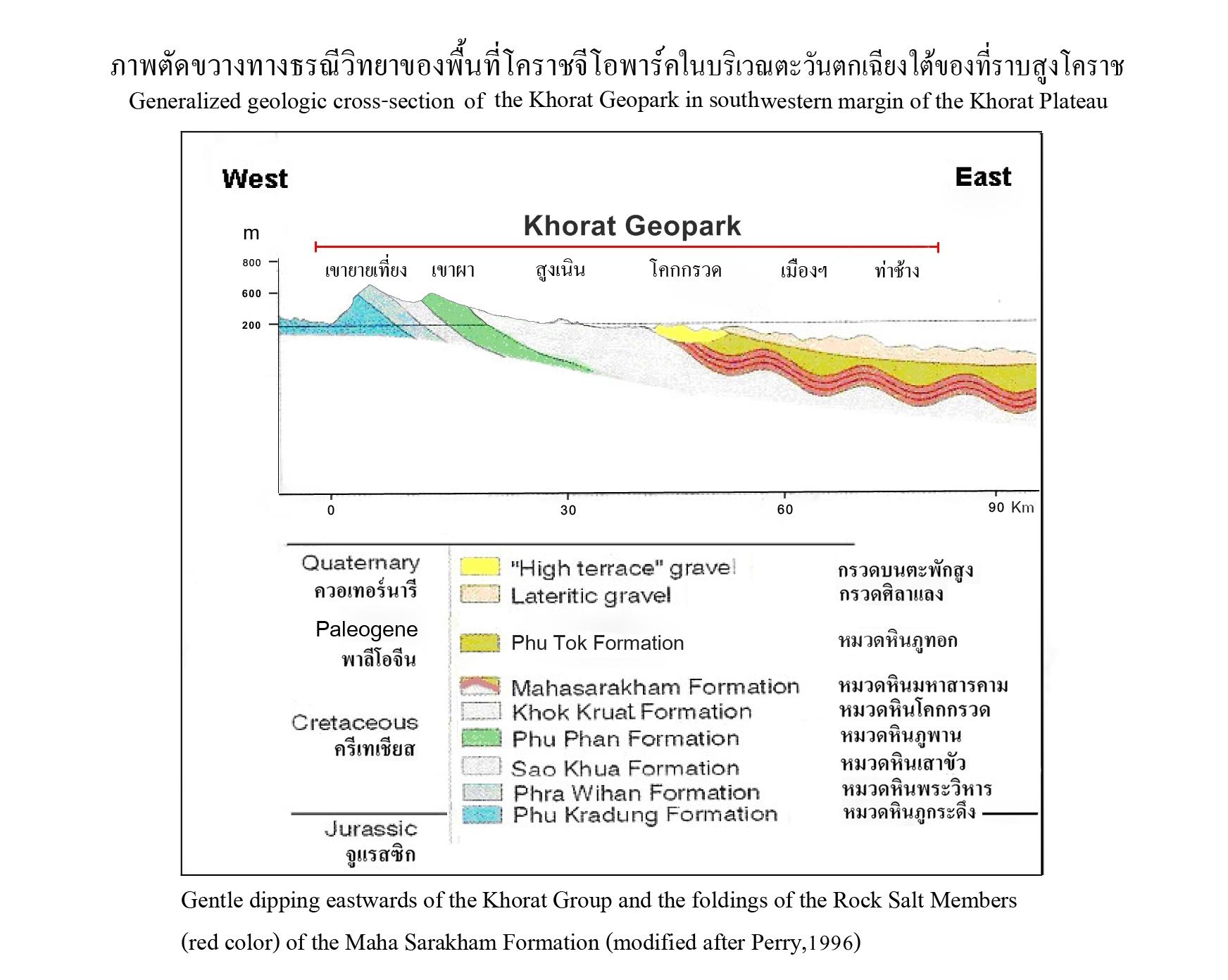
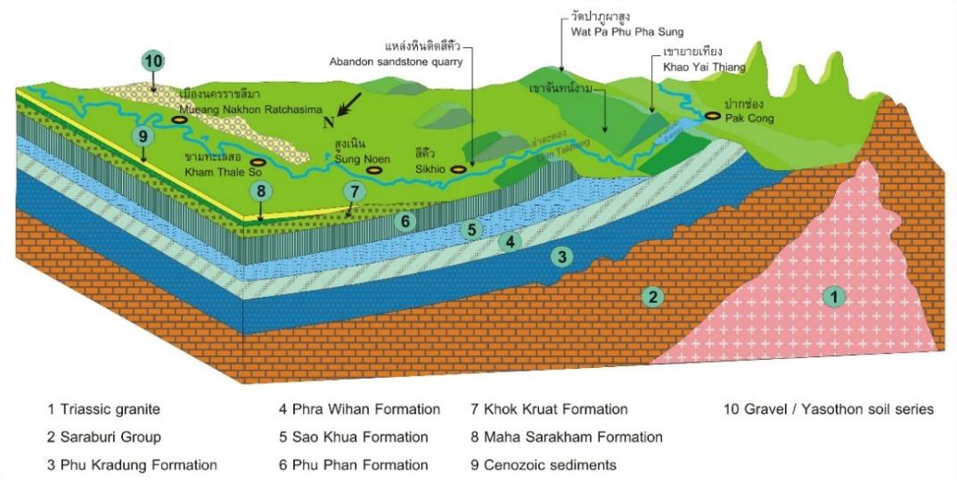
Khorat Geopark, part of the Khorat Plateau, is underlain by Mesozoic rocks of the Khorat Group, consisting of sandstone, conglomerate, siltstone, shale, claystone, and rock salt. The rising of the Himalayas 65 to 55 million years ago caused lifting and folding of the rock layers of the Khorat Group to form a plateau and a basin. Alternating layers of more and less resistant rock has resulted in the formation of 2 rows of cuestas in the western geopark region. In the center, the Early Cretaceous Khok Kruat Formation has yielded numerous fossil reptiles, including 3 new species of iguanodont dinosaurs and new species of turtle and crocodile. In the east, fluvial sediments, 60 m thick, from Neogene to Quaternary, have yielded 3 new species of fossil mammals, Khoratpithecus piriyai, an ancient orangutan, Merycopotamus thachangensis, a possible hippopotamus ancestor, and Aceratherium porpani, a hornless rhinoceros. Ten genera of ancient elephants have been recovered, out of 55 genera known worldwide: Gomphotherium, Prodeinotherium, Protanancus, Tetralophodon, Zygolophodon, Stegolophodon, Deinotherium, Sinomastodon, Stegodon, and Elephas. More than 20 other mammal species have been obtained as well as abundant fossil wood, fruits, seeds, and pollen.
Five geological features of international significance, ranked in order of importance, are
Geology and History of the Khorat Geopark Landscape
Formed by a late Triassic period collision between the Shan-Thai and Indo-China tectonic plates(approx. 201-237 million years before present), the Korat Basin preserves an incredible array of both plant and animal fossils. Spanning back as far as 145 million years (early Cretaceous), the fossil beds of Khorat Geopark provide a unique window into the geological and ecological history of the region. The tectonic movement of the prehistoric collision event elevated the Khorat Plateau, and forced lateral movement of the crust, causing the rock layers to bend and form two distinct basins of northeast Thailand. Separated by the Phu Phan mountains range, Sakon Nakhon basin stretches across the northern end of the region, and Korat basin to the south. The Phetchabun and Dong Phaya Yen mountain ranges can be found to the west of the Khorat Basin, and the San Kamphaeng and Phanom Dong Rak mountain ranges to the south. The fluvial processes of the Korat Basin extend from the Lam Takhong, through the Mun River, and into the banks of the Mekong River on the eastern border of Thailand and Laos.
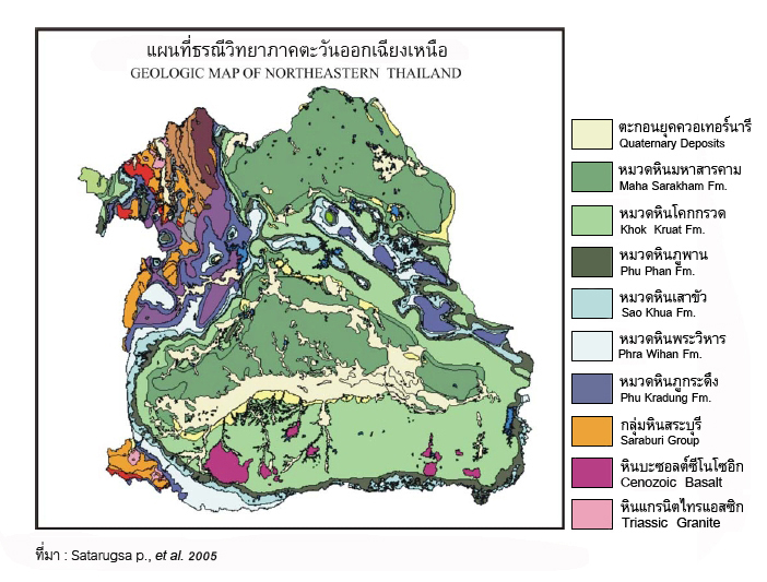
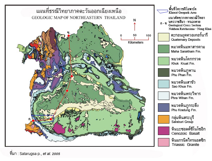

Geological formations and sediments found in Khorat Geopark