Geotourism
follow National Geographic’s Geotourism Principles (www.nationalgeographic.com/maps/geotourism/geotourism-principles/) and the “Arouca Declaration” discussed at the Arouca UNESCO Global Geopark in Portugal during the meeting there in 2011 on the topic of geotourism. Travel routes throughout the geopark were created to exhibit history and stories linking geology, biodiversity, culture, and community activities. Systematic tourism development training workshops have been held on several occasions. The most recent workshop for UNESCO Global Geoparks & Sustainable Tourism was held on August 18th – 21st, 2018, and was implemented by inviting international geologists and experts to join in the discussion on highlights and future of Geopark.
Progress and success of activities related to the sustainable tourism offer.
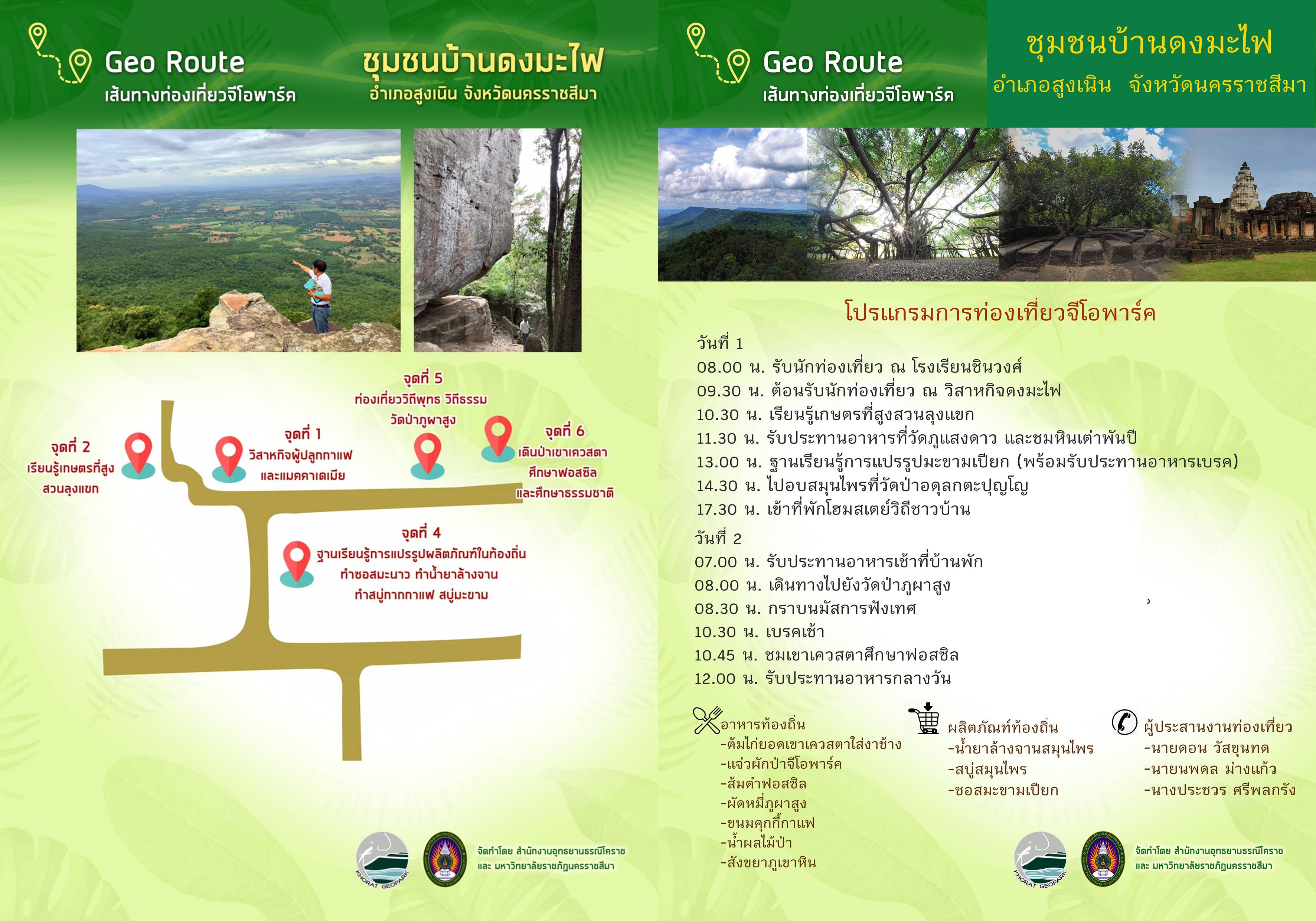
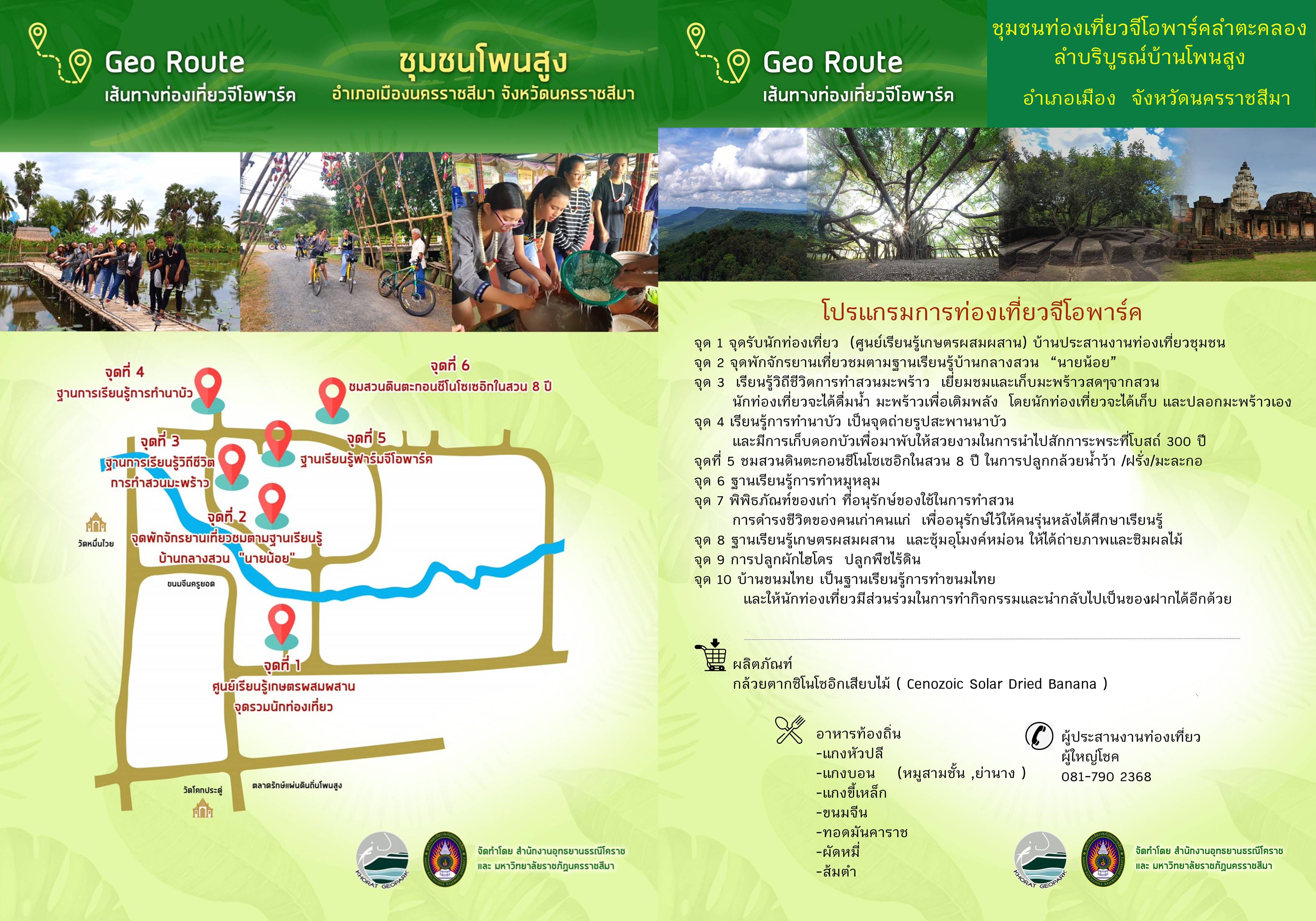
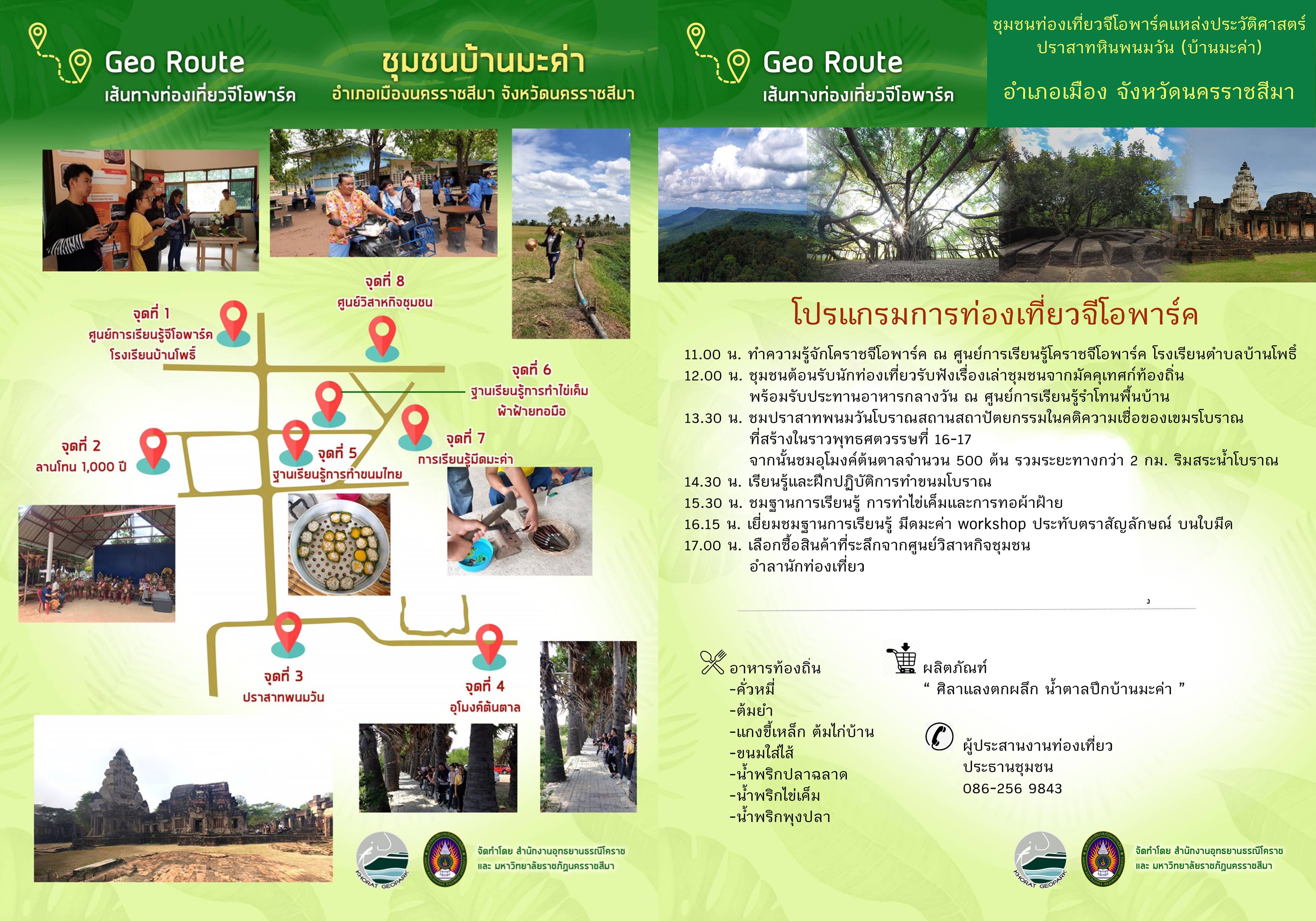
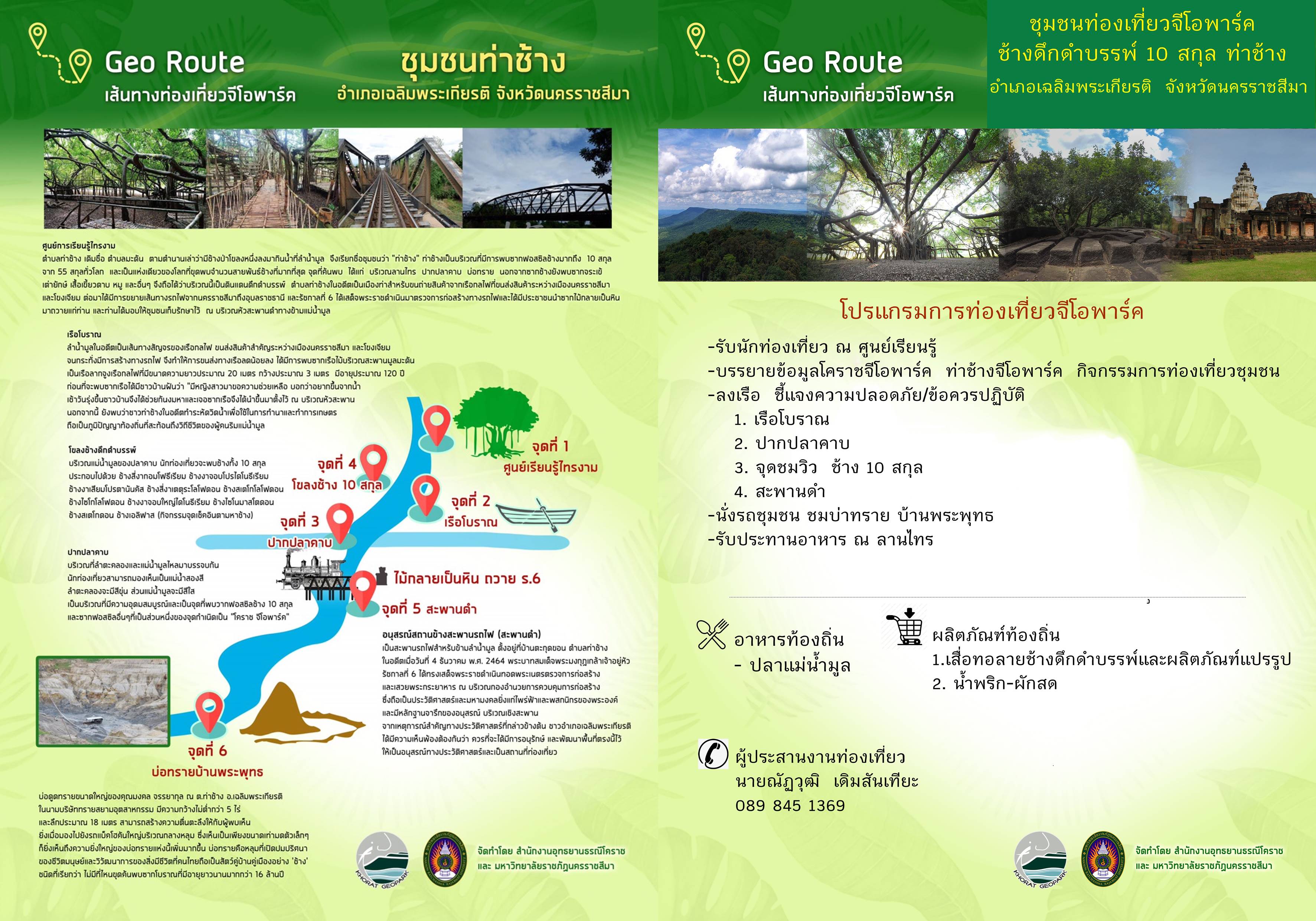
Geotourism routes Seven routes in the geopark were developed by local communities in cooperation with Khorat Geopark office. following criteria:
1. The number of tourist routes is in accordance with the context and appropriateness of the area. The Geopark has 2 prototypes, divided into 6 routes, with a center or starting point at the Khorat Geopark office. The first is a tourist route featuring fossils (the four-tusked elephant route) from the office to Chaloem Phra Kiat District. The second is a tourist route with a beautiful distinctive landscape view, which includes a route from the office to the cuestas and the Lam Takhong waterway in Sikhio District where tourists can also visit other archaeological and cultural heritage sites along the routes to learn about local traditional cultures and other aspects.
2. The names of each route were created to be attractive and comprehensive to visitors. There were a number of discussions to crowd-source ideas from the community to promote public participation and increase awareness of the value of local resources.
3. Travel time should be within 3-4 hours and not exceed 2 km from the main road. In the case of Khorat Geopark, most sources are near the national highway No. 2 Mittraphap Road. The Dong Mafai community and the Phu Pha Sung temple, for example, are conveniently located in close proximity to the main highway.
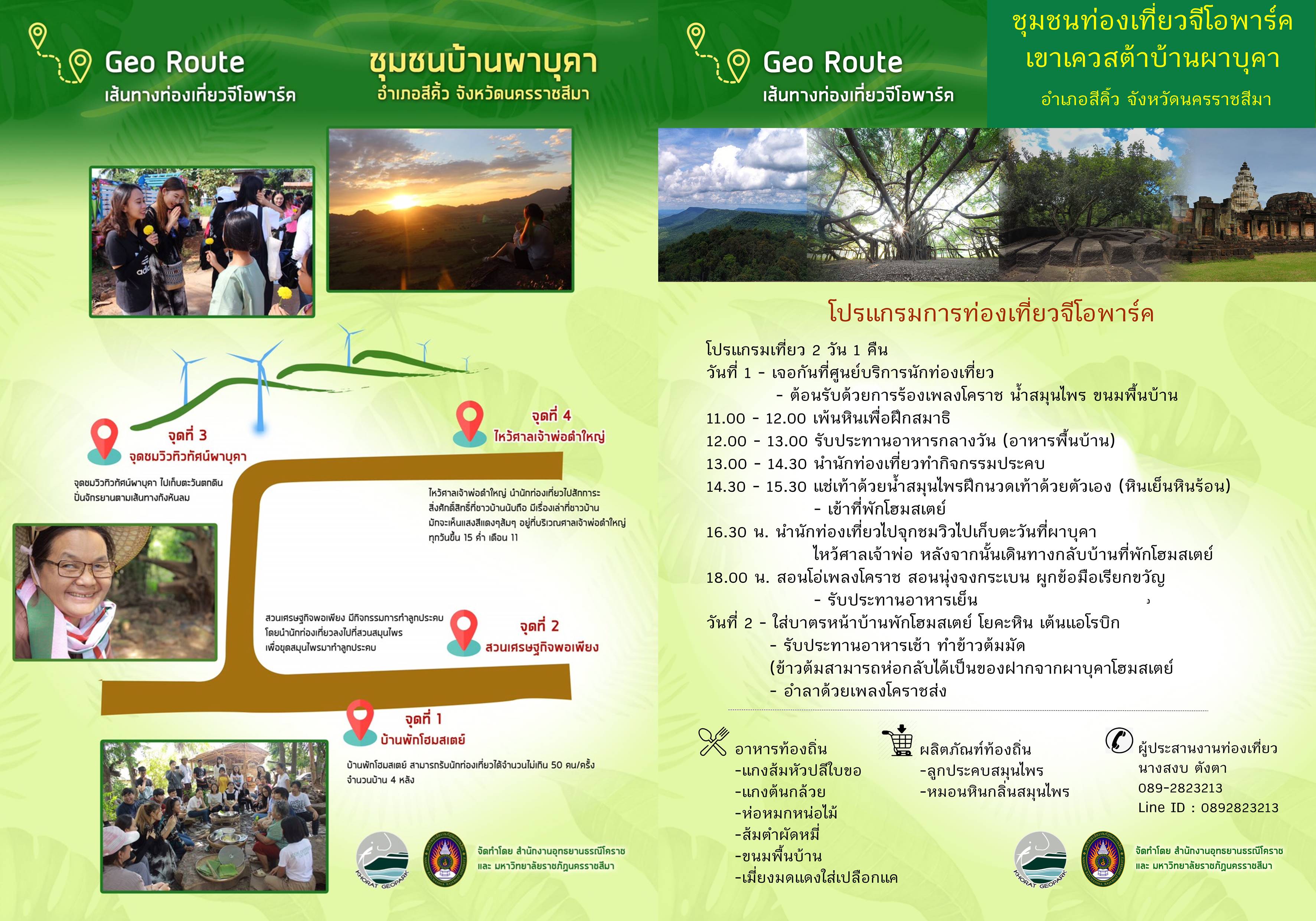
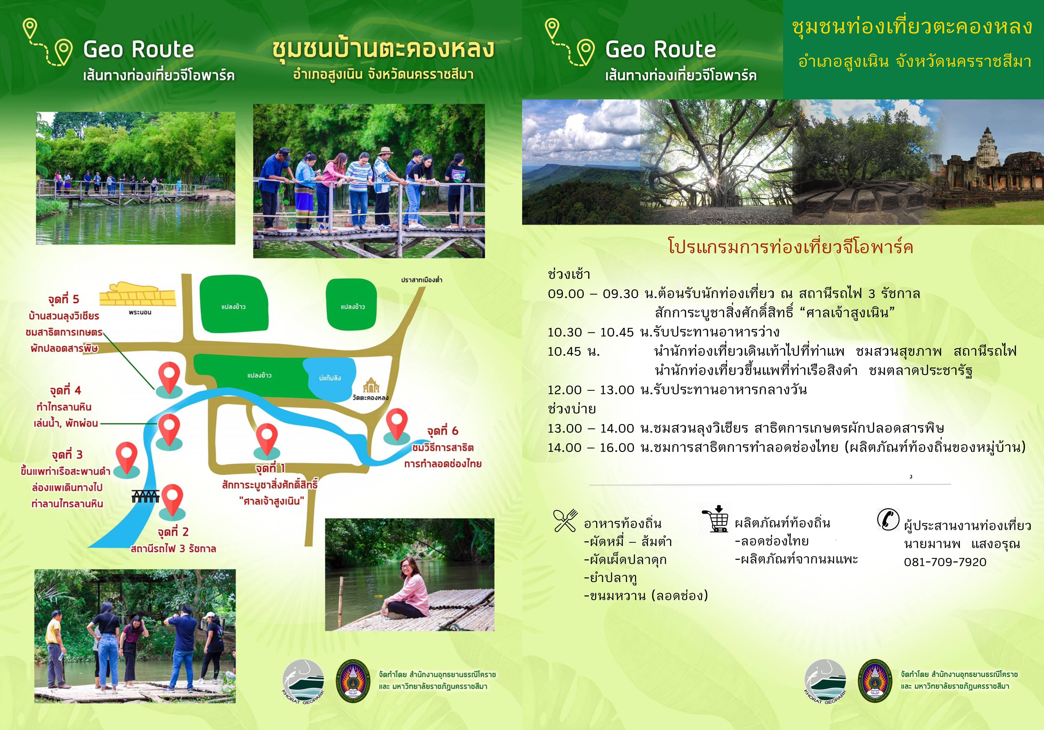
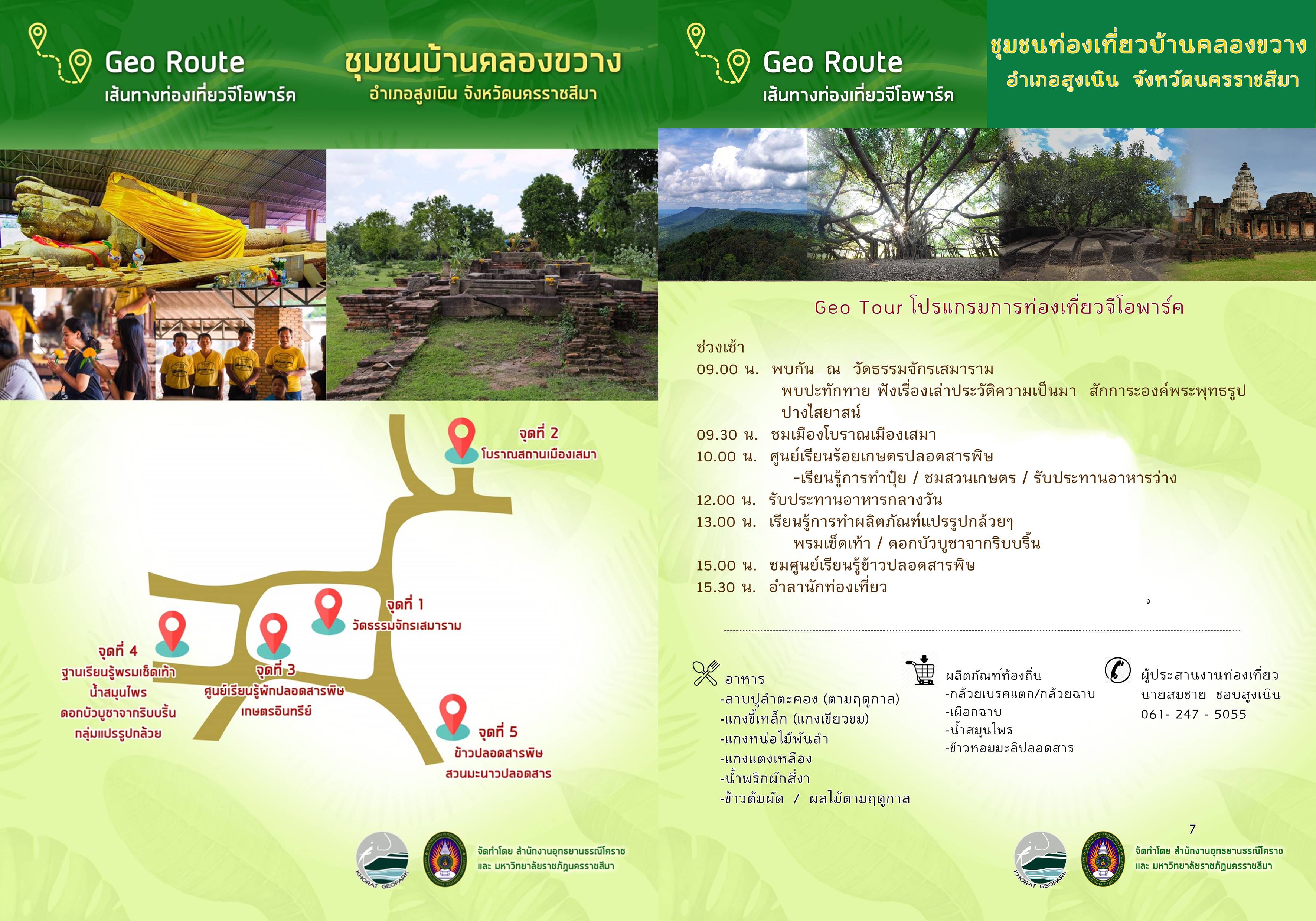
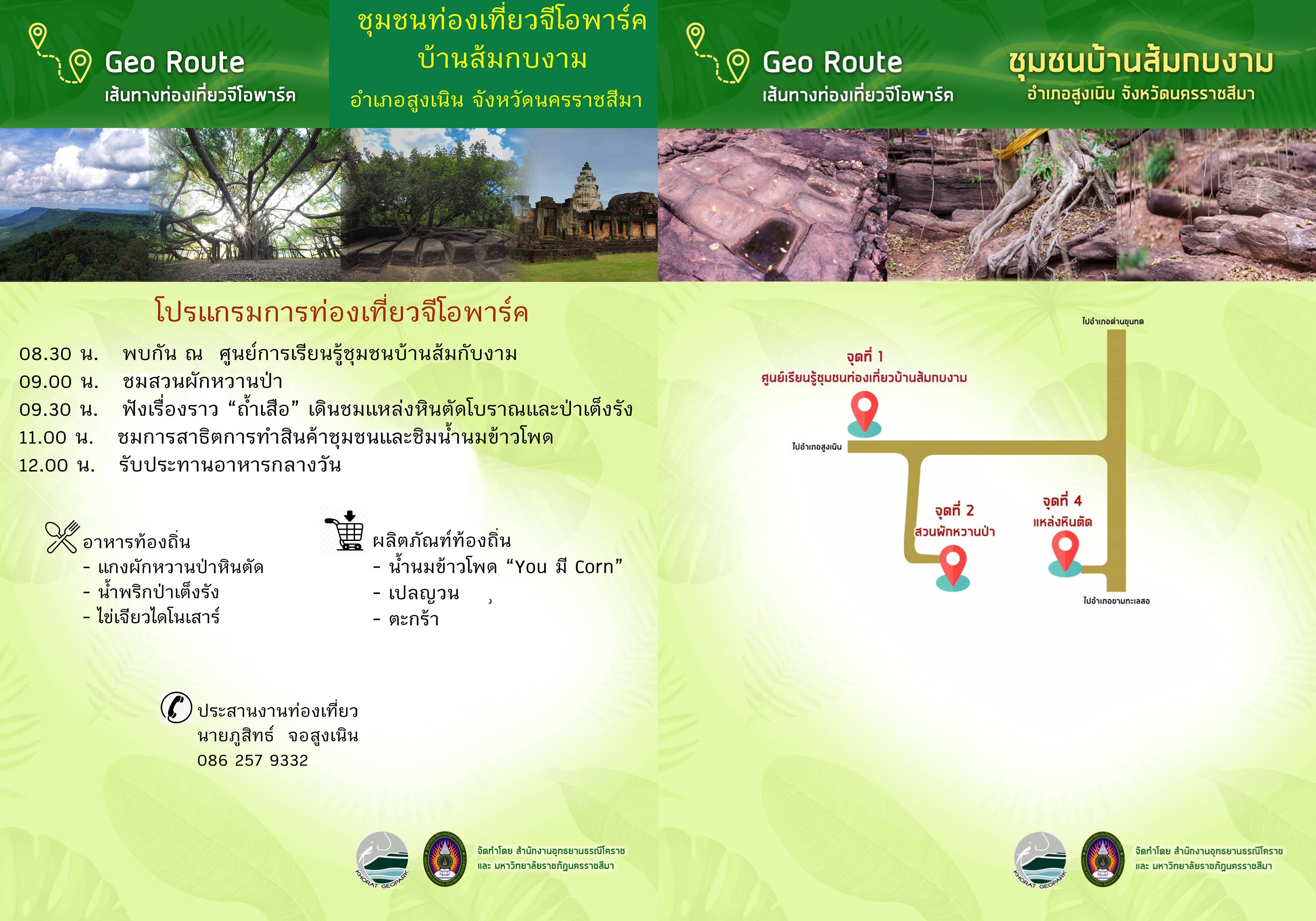
4. Each route should run through communities which have a distinct identity, i.e., 1: Four tusk, 2: Khorat Khmer Civilization, 3: Khong Dee Khee Kata Wisdom, 4: Sri Canasa Dvaravati Civilisation, 5:Tai-Yuan & Khu Rak Escarpment (Fig. E.20), 6: Khao Yai Thiang Cuesta; 7: Phu Pha Sung Cuesta.
7 Geotourism Routes in Khorat Geopark

Development plans and activities to be implemented
Meetings and activities will be held to develop a tourism management system using Community-Based Tourism (CBT). Areas that already have a well-functioning management system will be used to model the work for other areas. Workshops are held to create understanding and implementation of geotourism. English language training activities are held to develop communication standards for media personnel and tour guides in important geological and cultural areas of Khorat Geopark. Training activities for transportation service providers will be carried out. Marketing,
Geotourism Map of Khorat Geopark
**(please click right on each picture, and open in the new tab to get higher resolution)**
.jpg)
Khorat Geopark Geotourism
.jpg)
.jpg)
Geo Route in 5 Districts of Khorat Geopark
1. Sikhio District


2. Sung Noen District

3. Kham Thale So District

4. Mueang Nakhon Ratchasima District
5. Chaloem Phra Kiat District
New!

